New, very clean, nice design, excellent staff, comfortable rooms, excellent facilities, good food. Very well located for all south coast visits (waterfalls, glaciers, Golden Circle, Vik etc). Petrol station and supermarket just over the road.
The staff at the Stracta hotel were superb. So welcoming, eager to help, and great fun to chat to. They made the stay the great experience that it was. Food was good, cosy bar area, chance to see (potentially) northern lights from the outdoor hot tubs. Room decor was minimal but have what you need, and they were very clean. They haven't been open long but I foresee them doing well. I plan to go back!
Nice very modern hotel. This is a new hotel open for around one year. Facilities very good although we did not take up the front desk recommendation of using the hot tubs and sauna (way too cold outside for us). Have to say the food was excellent, we tried the a la carte the first night (limited choice) then the buffet second night, both times the food was really good. All in all I would recommend this hotel both for location (we used it as a base to drive North and West for Gulfoss, Geyser and Thingviller and the next day East for Seljalandfoss, Skogafoss, Eyjafjallajokull and Vik), facilities, food and best of all prices.
Lovely hotel situated in the middle of nowhere makes the perfect location for Northern Lights viewing, and if you miss them, lounging in a super-clean private hot tub in the frosty cold night makes up for it. Room was the cleanest we'd ever seen, with toasty comforters, a towel warmer in the bathroom and new bathrobes and slippers. Kitchen was clean and basic, and decor was no-frills. The lobby was adorable at Christmas-time, and the restaurant serves some of the best food in the area for dinner. Staff were friendly and helpful, and best of all, your private hot tub stays running the whole day!
We loved our stay here! Customer service was very warm and friendly, and super accommodating. We ended up going to the restaurant about the same time they were closing, and they still brought out food for us, and didn't rush us at all. Rooms are super clean with a wet bathroom (open shower). Hot tubbing under the stars was wonderful. Thank you! We'll definitely return on our next trip to Iceland.
Loved this hotel!! Warm and friendly welcome and staff. We were upgraded which was a bonus! Clean and comfy room. Ate at bistro both nights and food was tasty. Breakfast buffet offered a good range of hot and cold food. Great location for visiting Secret Lagoon and south of the island although bad weather hampered our plans during our stay! This hotel was great value for money. Thank you Stracta. We'll be back!!
I had booked thru Expedia with pretty short notice (under 2 weeks) in mid June of this year. Although it was somewhat expensive (Keep in mind it IS Iceland, most everything is $$). The stay was very very nice. The room was very clean. And everyone that worked there was great from the folks at the bar to the staff at the morning breakfast. Talk to the manager at the front desk, he's also a geologist and has a wealth of knowledge on the region's landscape, not to mention just a nice guy. We didn't do much in Hella (pronounced "Hetta"), but based there to make the drive out to Iceberg Lagoon and hit a bunch of sights along the way
I stayed at this hotel in April with Mom and Son. The complex is quite new and clean. The staff were friendly and helpful. We ate breakfast there everyday and had one dinner there. The food was good, but the dinner a bit expensive by North American standards. Nice hot tubs and saunas available for guests.
This hotel is a fascinating mix of stylish and basic. It is brand new, very Scandinavian in design. It is very clean and simple looking with little ornamentation, but it definitely has a stylistic point of view.
prima, lekkere bedden, goed ontbijt, service deed een stapje extra.
Prisvärt. Hotellet inte ens färdigbyggt, men rummet utmärkt. Frukosten värd sitt pris.
This hotel was a huge positive surprise! It's so brand new - or at least renovated just recently, comfy beds and really tidy. The breakfast was great as well.
Stracta Hotel was the first hotel we stayed on during our visit to Iceland and really set the bar high for the rest of the trip. The location is a great first stop if you are traveling along the ring road, or even just touring the south coast of Iceland (like we did).
The perfect base for exploring Iceland. The staff was helpful and attentive. The room was compact but meticulously clean and the bed is extremely comfortable.
the apartment was small and cozy. in the 2 bedroom apartment the second bedroom is really small. the suitcase also can't fit in. it has one bathroom between rooms. it had a hot water tub outside. it was a good experience. the breakfast spread was good. the hotel staff were friendly and warm. overall a good stay.
I stayed here with my 3 kids as part of a self-drive tour of Iceland, booked through a travel agency. So we stayed one night as we drove east, and then we stayed here another night on our way back heading west. The hotel is lovely - bright, modern, welcoming. Nice staff. Hot tub/sauna for all the guests. Nice breakfast buffet included. We had dinner there one night -- very good food (expensive relative to US prices, but no more than most places in Iceland)
The first night we stayed there, we were in a Studio room -- it had a bed for 2 people and a pull-out couch for 2 people. It was fine for a short stay, but with the couch open, there's not much room for luggage or to maneuver... my advice, if you're traveling with 4 people and plan to stay a few days, is to try to get an "Apartment" -- it had two bedrooms, a living space with nice kitchen, and a private hot tub. We were booked in an Apartment room on our way back to Reykjavik, much to my surprise. It was lovely and spacious -- I wish we could've stayed longer!
Yes, it's true that there's not much to do or see in Hella, but I love staying here when I visit Skogafoss. After a long day of hiking and admiring the beauty of Iceland, I found this hotel to be peaceful and relaxing. The rooms are small but comfy. I found the staff to be very welcoming and kind. Across the street is a small market in case you don't want to eat dinner at the hotel. I really enjoyed the breakfast in the morning. I will always give high remarks to a hotel that serves fresh croissants. I love visiting Iceland in the summer each year, but I think I might just come back to Stratca Hotel in the winter to see the northern lights.
A modern and beautiful hotel in a peaceful location with a stunning view of the vulcanos and glaciars. The rooms are in separete buildings where everyone have an own outdoor. In the rooms there is a kitchenette. Nice bathrooms. Very kind and helpful staff. The brakfast was very basic but there were everything you need.
The beds were so good so you never want’s to wake up. Hot tubs and saunas in the garden.
This is a simple, very clean hotel in a small village surrounded flat landscapes but no too far from numerous nature attraction absolutely worth to be seen. The hotel has two saunas (not hot enough for a Finn) and two bath tubs where about six persons and sit and chat outdoors in body-temperature water. Breakfast OK. Staff mainly from Slavic countries.
We saw the northern lights here - so that in itself made for an AHHHMAZING experience! Bungalows/suites are nice and equipped with anything you could need. Staff is very good, food was decent, and drinks are well made. There was nothing incredibly spectacular about the hotel, but it was very good stay. I could see how someone would think the rooms were small, but if you book a suite that won't be a problem. Keep checking the rates after you book - the rates kept dropping as we got closer to our arrival date.
Hôtel tout neuf, ayant ouvert 15 jours auparavant, très bon accueil, espace bar-salon chaleureux, entrées gratuites à la super piscine de la ville!
Rúmin voru frábær, sængurfötin og handklæðin. Barinn skemmtilegur og gaman að horfa út í garðinn.
This is a very nice hotel! The staff of the hotel is very friendly and the hotel is clean.
My husband and I were in Stracta hotel for our honeymoon and we really liked it.
This was a lovely hotel. Hot tub and sauna were a nice surprise. Kitchenette was great although a sharp knife would have been a good addition. The breakfast was good - a combo of cooked food and continental. We had a super one night stop over here.
Great location for travelers along the southern route. Bare bones but superbly efficient and clean facilities. Excellent breakfast. Hot tub and sauna are refreshing touches.
This hotels' standard room is not spacious enough for two beds; one double bed and one sofa bed. No space for table or desk. Good breakfast. In overall good stay.
This hotel was the last leg of our ring road trip in Iceland. Clean, well appointed rooms that were perfect. The hot tubs were a welcomed treat after a week of hiking. Great options for breakfast. The bonus was my son left his watch in the room and didn't realize until we were at the airport. I called the hotel and explained the situation. They found the watch and mailed it back to the US and wouldn't even let me pay. Customer service was amazing and my son we overjoyed when it arrived. Would definitely stay again. Thank you again!
Personale gentile e preparato, colazione eccellente, rapporto qualità prezzo ottimo, possibilità di sauna e jacuzzi riscaldata, ristorante dell'hotel buono, stanza discreta e pulita... in due parole il migliore albergo della nostra vacanza islandesa. Consigliato
Stopover for a night before continue journey to Vik. Gotten a free upgrade from room without bathroom to room with bathroom. Comes with basic necessity. There are facilities like outdoor sauna and jacuzzi free for use. There is even Aurora sighting wake up call service provided. What’s more? Hotel comes with complimentary breakfast. Lots of food to choose from. Good stay.
Prettige ervaring binnen dit hotel, ze hadden zelfs een noorderlicht service
great place with an awesome view at breakfast. delicious breakfast! night staff was great at check in & one of the guys went out his way to take care of us when we got there late & all restaurants closed.
Amazing value if you are in the area. Staff bends over for you. Extremely friendly. I turned one night's stay into 2. Also car rental available there for Highlands. Decent breakfast, although, the second day almost everything that was supposed to be hot was cold.
Hotel Stracta was awesome! The location in Hella was perfect as a midway point on our trip. It's also pretty dark there at night so I would assume you can see the northern lights during peak months (I didn't see the NL when I was there but I went in Sep). The hotel itself is pretty new and nicely furnished. The private geothermal hot tub that comes with the 2 bedroom units is amazing. Totally worth the price to have the private tub. Breakfast is nice too (waffle maker!).
What an awesome place to stay for incredible value in Iceland! The room was small but clean and suited its purpose as an overnight stay. The location is great and perfect for the Northern Lights. They even have a special ‘Aurora Call’ so that you don’t miss them overnight. The hot tubs and changing rooms are clean and just perfect for watching the stars. Breakfast had a great hot and cold selection too. Staff were polite and friendly throughout the stay
The breakfast selection was great, the best out of the 4 hotels we stayed at! Loved the property and the hot tub. Also we saw the northern lights during our stay and that was just the cherry on to.
REGARDING THE VOLCANO: The area is constantly evolving, with hiking paths being changed as the flow of lava changes. Therefore we kindly ask everyone to please follow the rules and guidelines set out by the police and ICE-SAR (Icelandic Association for Search and Rescue) while visiting the volcano.
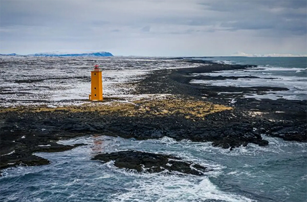
South Coast Lighthouse Trail
|
Selvogsviti lighthouse |
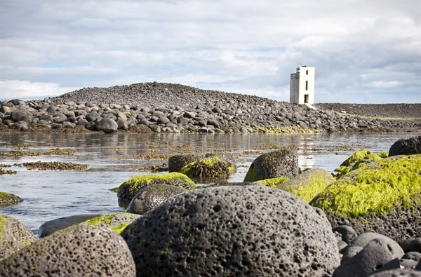
Hafnarnes lighthouse |
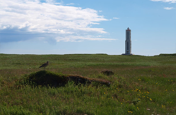
Knarrarósviti lighthouse |
The towns
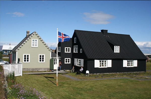
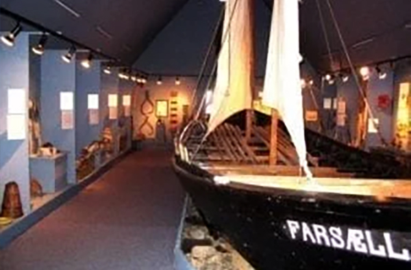
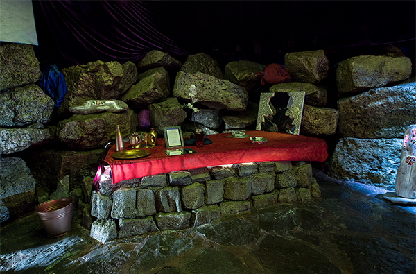
During the travel on the Lighthouse Trail, you might want to visit a museum to soak up the significant history of fishing, trade, and life in the area that has shaped the villages along the coast over the centuries. Here's what the villages along the coast have to offer.
|
Þorlákshöfn |
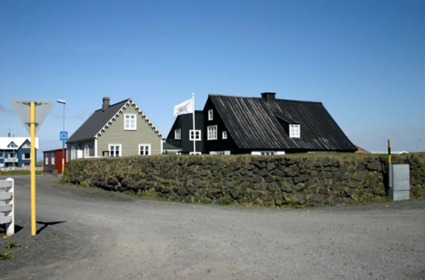
Eyrarbakki |
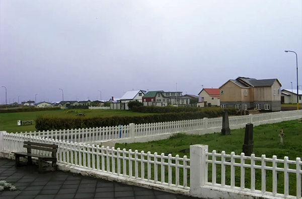
Stokkseyri |
Stokkseyri, Eyrarbakki and Þorlákshöfn, are unique, each in its own way. They are all fishing villages, although nowadays fishing is only done from Þorlákshöfn. Eyrarbakki is the oldest village of those three. The oldest house in the village is called Húsið (e. the House) and was built in 1765. During the Danish king's monopoly Eyrarbakki was one of the largest towns in Iceland, even larger than Reykjavík. For a while, it looked like Eyrarbakki, with all its services and trade, would become the capital of the country.
Around 1890, the formation of Stokkseyri began, and this period of development lasted until 1930. Wooden houses with corrugated iron gradually built up instead of the traditional turf houses. Today, the village is characterized by a mixture of old and new houses, an old fish processing factory and next to it the Stokkseyri Church. On the observation platform, south of the cemetery, you can find information about the lay of the land and place names.
Þorlákshöfn gets its name from Þorlákur, the holy bishop of Skálholt (1133-1193). Þorlákshöfn possesses an excellent natural harbor and is close to rich fishing grounds. In the period when rowing boats were used it was common for 30-40 boats to be fishing from Þorlákshöfn, meaning that 300-400 people lived in the fishing station over the season, living in dwellings made of stone and turf. The current urban area was formed around the middle of last century following the development of a powerful fishing company Metill hf. There was also a significant increase in population in the seventies following the volcanic eruption in Heimaey in the Vestmannaeyjar archipelago. Extensive development has taken place in Þorlákshöfn in recent years.
Museums
This part of South Iceland is an area with a diverse history and culture. The three listed below are some of our favourite ones and we can highly recommend them.